Skip to main content
U
niversity
of
W
isconsin
–Madison
Atmospheric and
Oceanic Sciences
Search this site
Submit search
Menu
Home
About
Department
People
News
History
Diversity, Equity, Inclusion
Awards
Contact Us
Resources
Department Documents
Mentorship and Teaching
Health and Wellness
Professional Development
Outreach
Local Life
Reporting misconduct
Accessibility Resources
Research
Overview
Synoptic Meteorology
Climate and Climate Change
Large Scale Dynamics
Radiation and Remote Sensing
Cloud and Atmospheric Physics
Oceanography
Software
Graduate Research Opportunities
Journal of UW-AOS (includes M.S. and Ph.D Theses)
Academics
Prospective Students
Undergraduate Program
Research Graduate Program
Professional Master's Program
Journal of UW-AOS (includes M.S. and Ph.D Theses)
AOS Course Listing
Scholarships
Careers in AOS
Graduate Research Opportunities
Teaching Assistantships (TA)
Alumni
Weather
Climate
Wisconet (Wisconsin's Environmental Mesonet)
Wisconsin State Climatology Office (SCO)
Center for Climatic Research (CCR)
Center for Sustainability and the Global Environment (SAGE)
Climate, People and the Environment Program (CPEP)
Partners
Donate
People
News
Calendar
Map
Weather
Home
weather
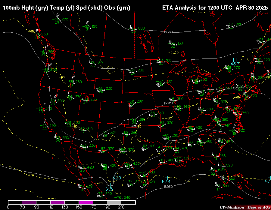
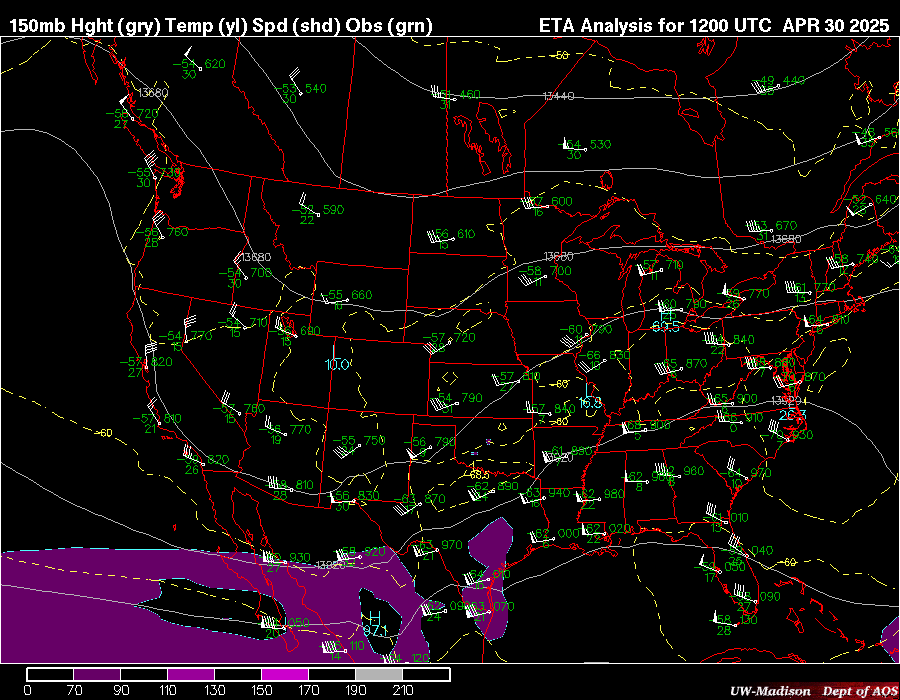
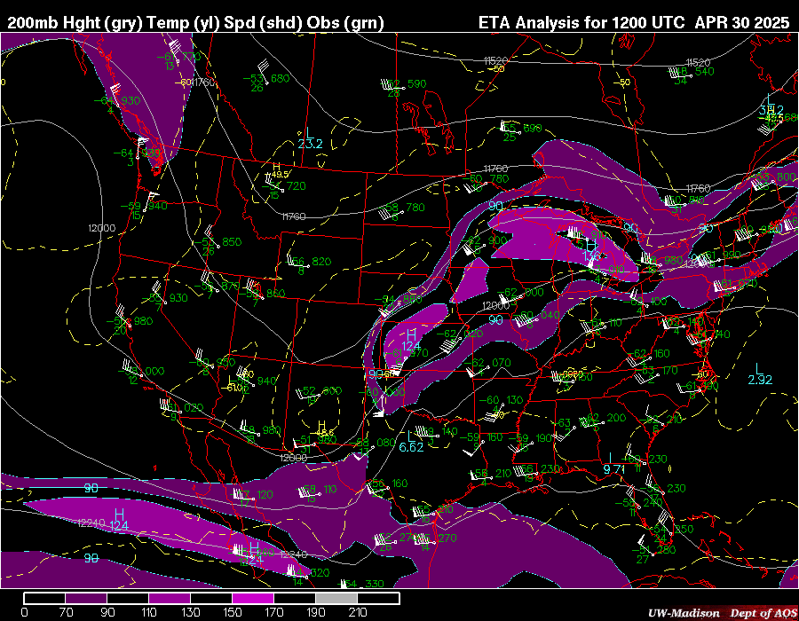
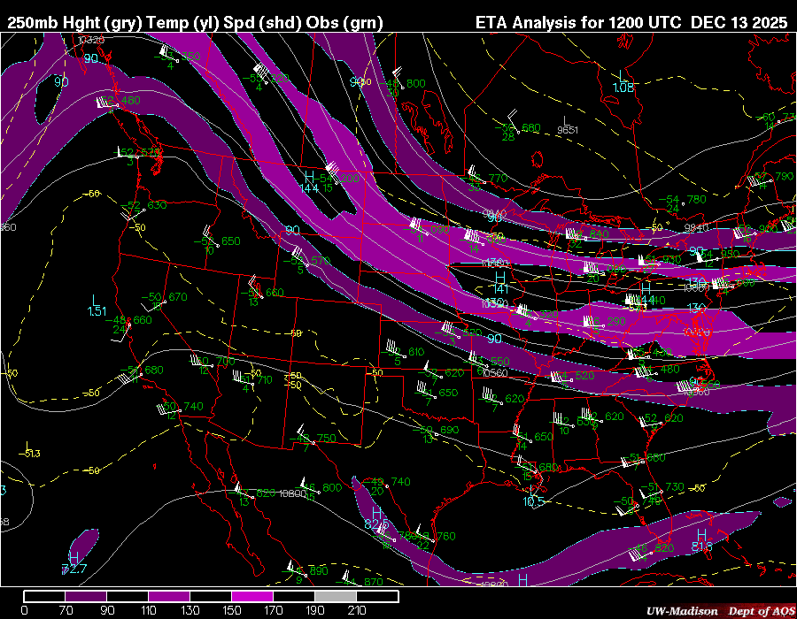
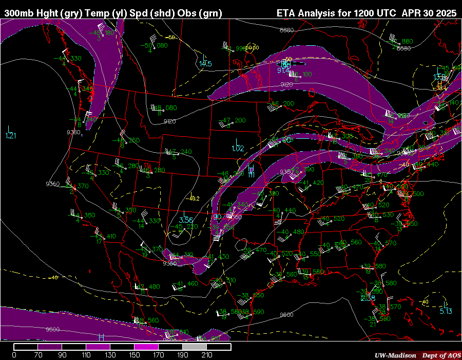
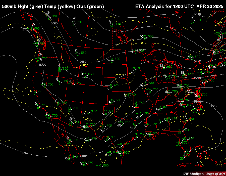
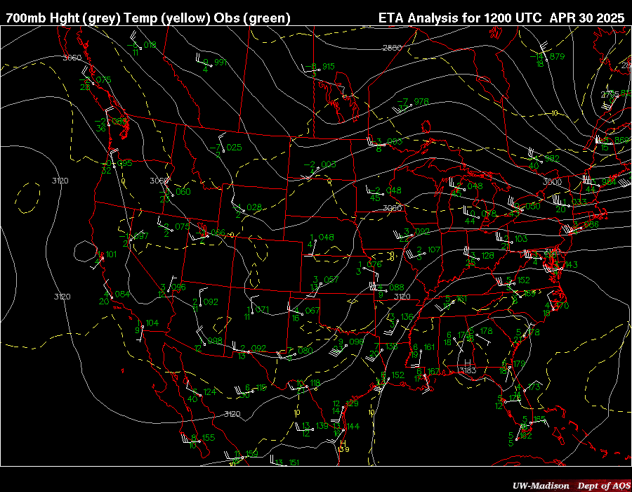
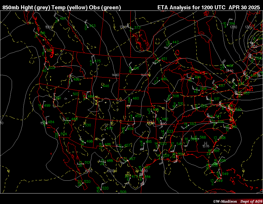
Upper Air Observations
Upper Air Observations
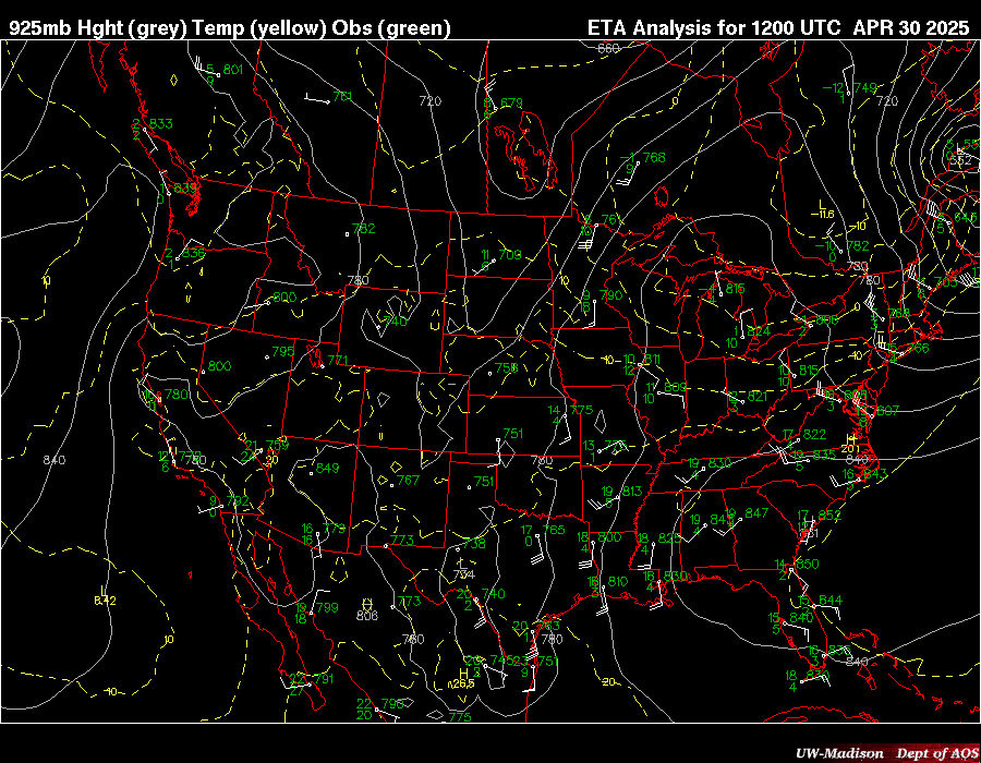
Upper Air data used to create these maps are provided by NOAA/NWS and NSF Unidata
Most recent observations with analysis from the NCEP NAM model
100 Mb
150 Mb
200 Mb
250 Mb
300 Mb
500 Mb
700 Mb
850 Mb
925 Mb
Site icons
More
open menu
close
search
search
search
envelope
pinterest-p
twitter
youtube
facebook
instagram
facebook
facebook
Collapse
Expand
next slide
previous slide
Footer Crest
