
Turbulence case studyeadings
AA
10 July 1997 -- Severe Turbulence Injures Passengers and Forces Jet to Make an Unscheduled Landing
|
|
-
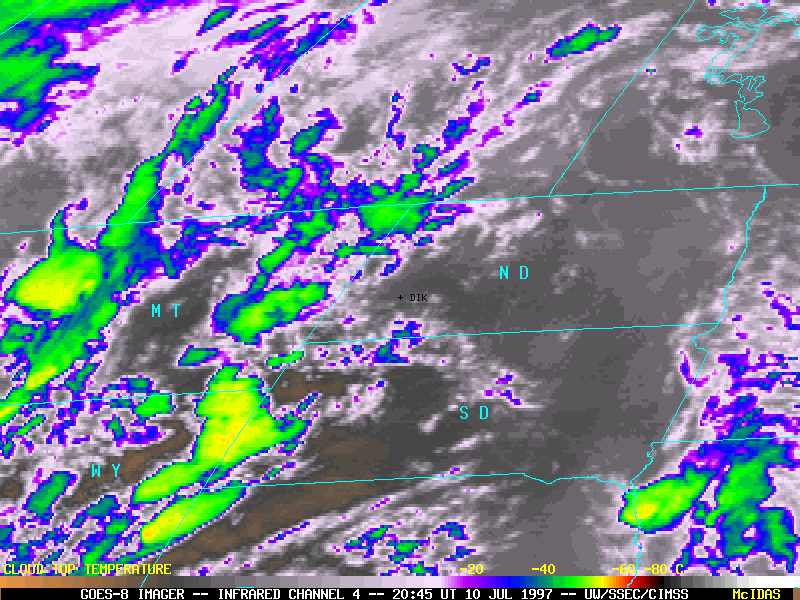
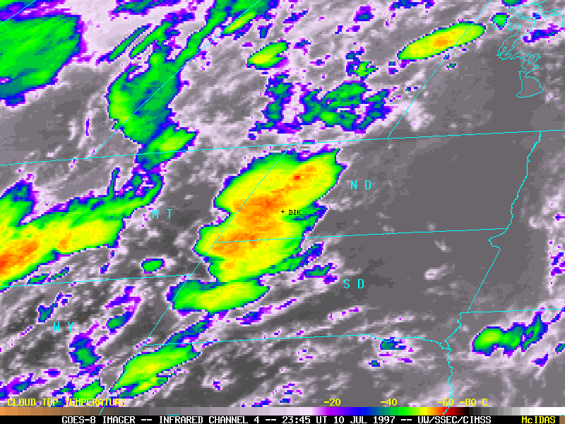
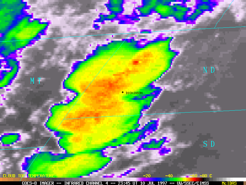
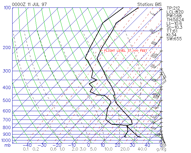
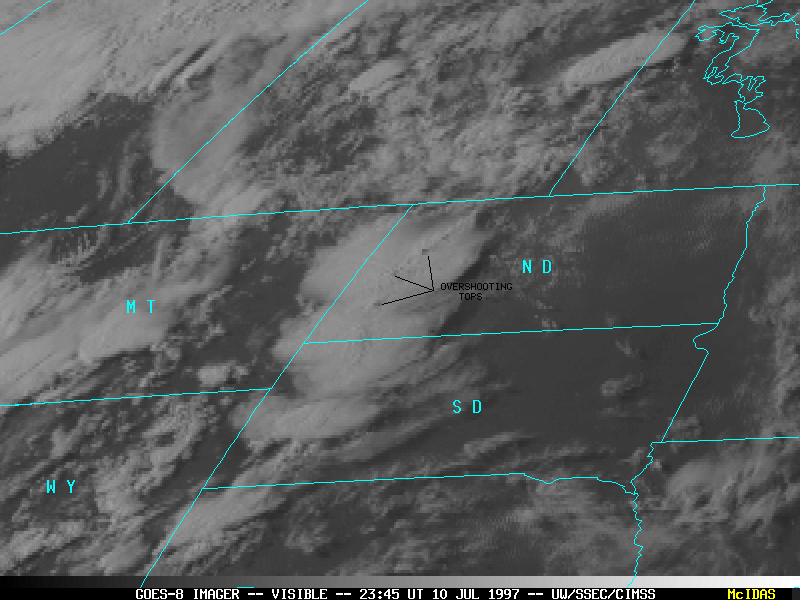
Atmospheric turbulence at typical jetliner cruising altitudes can result from convective activity or from a variety of non-convective phenomena (jet stream circulations, deformations zones, orographic waves, gravity waves, Kelvin-Helmholtz instability). The GOES-8 infrared imagery above reveals that a cluster of thunderstorms was rapidly developing across southwestern North Dakota around the time of the incident. The image 1 hour prior to the event (left) shows disorganized convection building over far eastern Montana and the Black Hills region of Wyoming and South Dakota, while the image 2 hours after the event (right) shows a well-developed convective cluster with cloud top temperatures colder than -60 C over the Dickinson ND region (see magnified IR image). The rawinsonde report from Bismarck ND (just east of the convection) indicates that these -60 C cloud tops would have penetrated above the level of the aircraft (the temperature at the 37,000 foot level was about -52 C). A visible image at this time revealed cloud shadows from overshooting tops, indicative of vigorous thunderstorm updrafts.
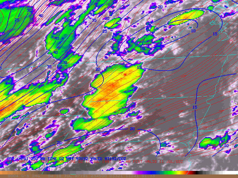
Turbulence due to jet stream circulations was not likely a factor in this event -- wind fields from the ETA model indicate that the core of the strongest jet stream winds (45 ms-1 or about 90 kts) was over far western Montana into southern Alberta, and the flow over the Dickinson ND region was southwesterly at only 15-20 ms-1 (30-40 kts).
Additional details about this turbulence event can be found at the NOAA Forecast Systems Laboratory.