
Cloud Identification, from the ground
Low Clouds
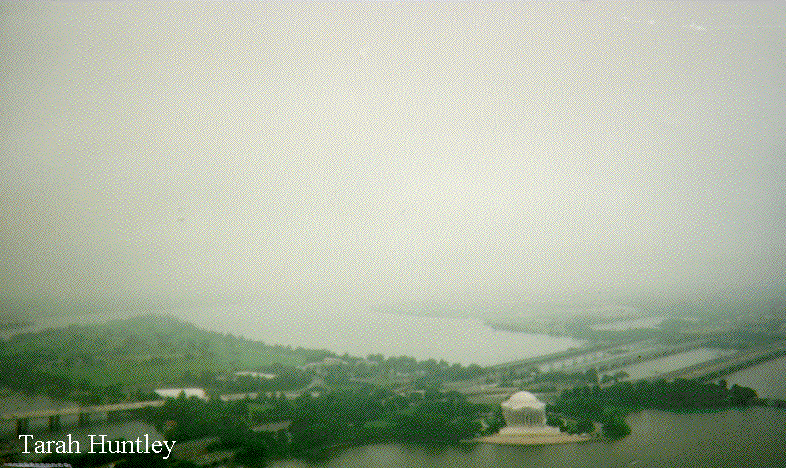
Stratus (St)
These low altitude clouds, abbreviated St, are diffuse in appearance. From the ground they appear as light to dark gray in color and cover the sky. These clouds are common along coastlines and in valleys. Early morning fogs may lift and form a stratus deck. Stratus may also originate when moist, cold air is advected at low altitudes over a region.
Stratocumulus (Sc)
These low lying clouds cover the sky and appear white to gray in color. Unlike stratus, stratocumulus have more structure that appears as variations such as rows or patches. Stratocumulus are distinguished from stratus by these variations in color across the sky. As with stratus, stratocumulus are frequent is certain geographic regions, such as along coasts and in valleys. Cold air passing over warmer water will also produce stratocumulus. This is why this cloud is common in the winter near the Great Lakes. Stratocumulus also accompany cold fronts. When associated with a large weather system, stratocumulus are often the last cloud to appear before the skies.
Middle Clouds
Altostratus (As)
These layered clouds consisting mostly of liquid water are gray to pale blue in appearance. These clouds form when the middle layers of the atmosphere are moist and gradually lifted. The cloud base does not have much structure. If the sun appears through these clouds, it has a "watery" appearance. The height of the cloud base is hard to distinguish because of its smooth appearance. Altostratus clouds are common in the advance of a warm front, preceding the nimbostratus. Over the central United States, they also form from outflow of severe thunderstorms.
Altocumulus (Ac)
The appearance of altocumulus varies considerably. They can be thin or thick, white or gray, occur in organized lines or random distributions. They occur in the middle levels of the atmosphere when the air is moist. They are similar in appearance to stratocumulus, though with a higher cloud base and generally do not fill as large a part of the sky. A "mackerel sky" is one that contains altocumulus clouds. Altocumulus clouds appear in the advance of a warm front, preceding the altostratus. If the altocumulus clouds appear with other cloud types, an approaching storm is likely. Altocumulus occur frequently and are common in many places of the world.
High Clouds
Cirrus (Ci)
Cirrus are wispy, fibrous, white clouds that are composed of ice. They are a common cloud type that occurs in vertical motions ahead of large scale weather patterns. Cirrus clouds are associated with all weather systems. They can also be generated by flow over mountains or in regions with strong winds, such as the jet stream. They often occur as wisps aligned in the same direction and generally do not completely cover the sky. When isolated cirrus occur, they are not indicative of a weather disturbance. Cirrus clouds similar in shape to a comma are cirrus uncinus or mares tails.
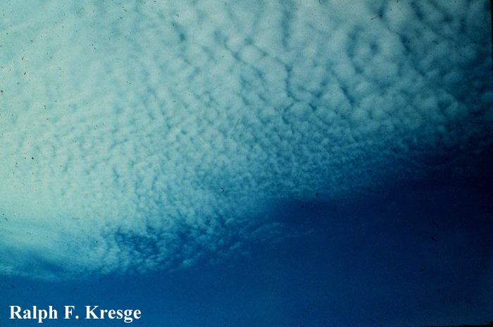
Cirrocumulus (Cc)
Cirrocumulus clouds are thin, white clouds that appear in ripples arranged in a regular formation. They are distinguished from altocumulus by the smaller size of the individual cloud cells. While these clouds occur year round, they are not very frequent and are usually present with other cloud types. Cirrocumulus are often associated with large weather systems.
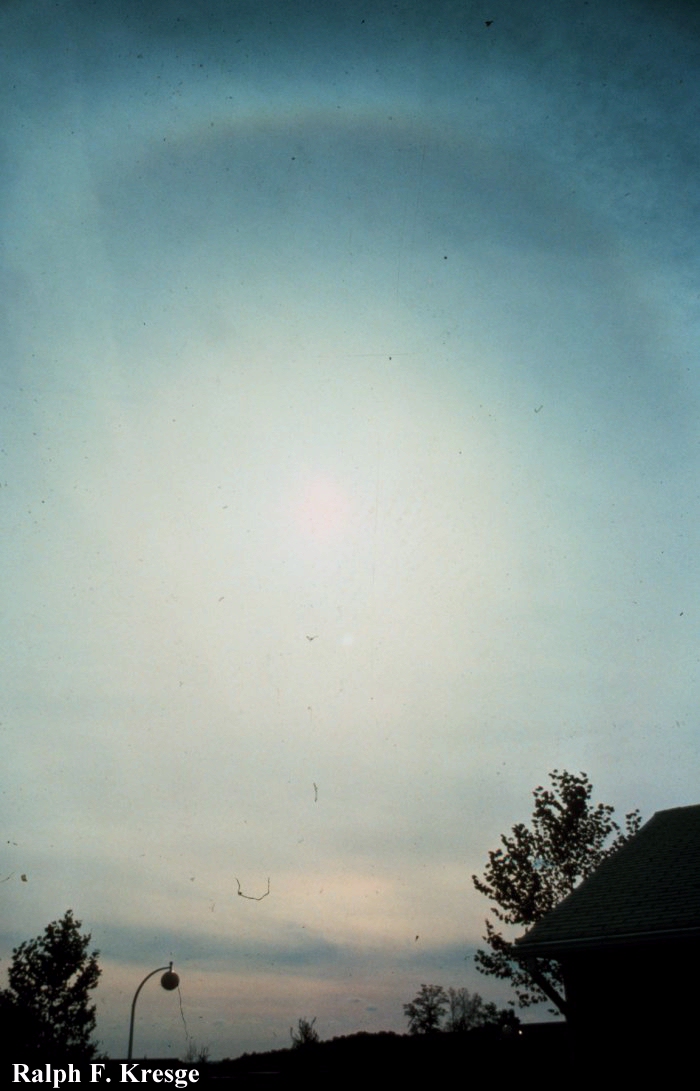
Cirrostratus (Cs)
Cirrostratus clouds can cover part or all of the sky. They are uniform in appearance and can be thin or thick, white or light gray in color. If the cirrostratus cloud thickens into an altostratus, it is indicative of an approaching weather disturbance. Cirrostratus often form thin veils through which the sun can easily be viewed. Halos around the sun, bright arcs, and brilliant spots are optical phenomena associated with sunlight passing through the ice crystals composing the cirrostratus.
Vertical Clouds
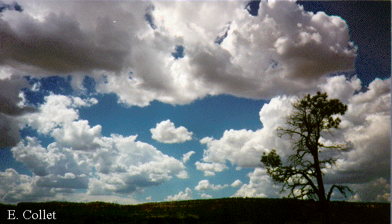
Cumulus (Cu)
Cumulus clouds generally have well-defined, flat bases and domed tops resembling cauliflower. The edges of the cloud are distinct. The bases are generally dark and the sunlit sides bright white. These clouds form whenever rising air associated with large scale weather systems has a high relative humidity. The height of the cloud base is a function of the relative humidity of the rising air. There are two basic forms of cumulus clouds, fair weather cumulus and cumulus congestus. Fair weather cumulus clouds have a height that is similar to its width. These clouds are common in summer when air rises due to convection resulting from solar heating of the surface. During autumn and winter cumulus form over large open lakes. Fair weather cumulus are not deep enough to cause rain, though some may grow into large storms. Cumulus congestus or towering cumulus have a vertical depth that is greater than their width. To form the atmosphere must have an unstable layer that is deeper than required for the formation of the fair weather cumulus. Cumulus congestus tilt if the wind speed increases with altitude. These towering clouds are common in summer and may have light rain falling from them. In regions like Florida, cumulus congestus may produce heavier rains for a few minutes. When cumulus congestus form in the morning it is a good indicator that storms may form later in the day. If the tops appear fuzzy, ice is forming and the cloud may be developing into a cumulonimbus.
Rain Clouds
Nimbostratus (Ns) Nimbostratus are deep clouds that bring precipitation and appear dark gray to pale blue in color. The structure of the base is ill defined and so nimbostratus sometimes look similar to stratus, stratocumulus or altostratus, the difference is that nimbostratus produce precipitation. Nimbostratus are often associated with the passage of warm fronts. Nimbostratus may quickly develop into a thunderstorm.
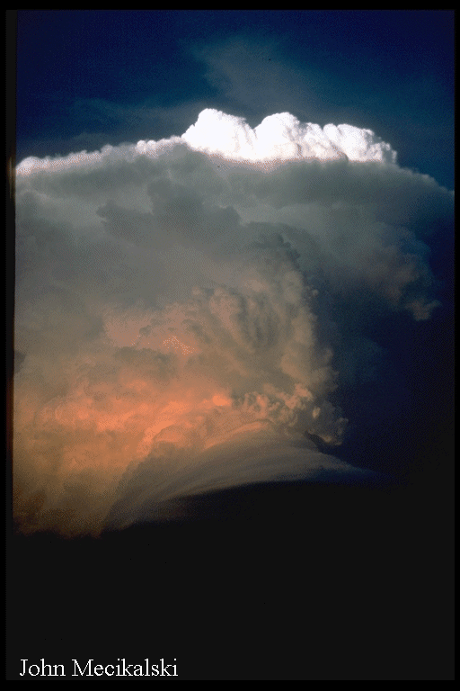
Cumulonimbus (Cb)
Cumulonimbus reach to high altitudes, often to the tropopause, and produce large amounts of precipitation. The tops of cumulonimbus are often seen on the horizon while the bases are not in view. A distinguishing feature of the cumulonimbus clouds is the anvil. This is the part of the cumulonimbus that appears flat near the top and extends a long distance downwind from the central updraft of the cloud. This flat part of the cloud is similar in shape to the anvil used in metal smithing. Cumulonimbus clouds form in unstable, moist atmospheres and are common in spring and summer. They often occur in the advance of a cold front. In summer they can form over mountains due to orographic lifting in combination with solar heating. Precipitation falls from these clouds and severe weather (lightning, hail, tornado, flash flood) is common. Cumulonimbus can be isolated storms or organized in groups. When cumulonimbus clouds form together in an organized system, the chance of severe weather increases.
Special Clouds
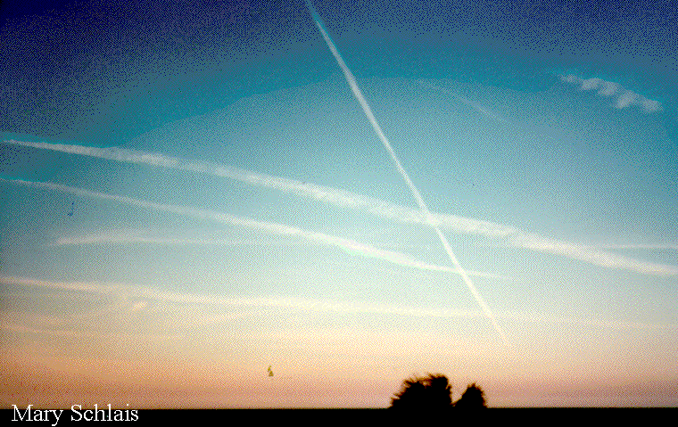
Contrails
The previous clouds all formed as a result of rising air. The formation of contrails is similar to the mixing fog. Parcels of air from jet engines and the environment that are unsaturated are mixed resulting in a supersaturated parcel in which a cloud forms. The presence of contrails can be an indication of the humidity of the upper troposphere. If the number of contrails is increasing or if the contrails are spreading, then the upper troposphere is more humid.
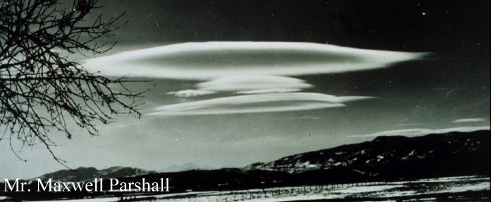
Lenticular
Lenticular formed clouds are shaped liked lenses or flying saucers and are symmetric. They are often generated as air flows over mountains and are common east of the Rocky Mountains. The clouds appear anchored to the mountain. These clouds form when the air is stable downwind of the mountain, the wind flows over the mountain in a wave-like pattern, and lenticular clouds are often generated in the ascending air over a mountain. On the descending branch of this mountain generated wave, air is compressed, warmed and the cloud evaporates as the relative humidity decreases. This flow pattern is called a mountain wave. Lenticulus clouds can form whenever the air flow undulates in a regular pattern. While the clouds appear smooth, the vertical motions are very strong and turbulent. Aircraft avoid flying at the altitude at which lenticulus clouds form.
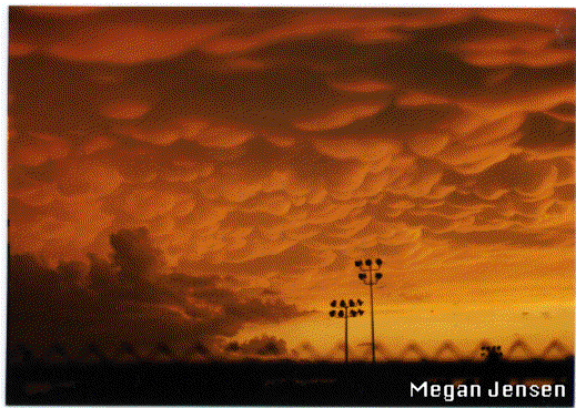
Mammatus
Mammatus cloud derive their name from their pouch-like appearance. Mammatus clouds often form on the bottom of a spreading anvil associated with a large, active cumulonimbus. Mammatus clouds often follow, within minutes to an hour, the most active stage of a cumulonimbus. If the mammatus are far off and not approaching, you may be spared experiencing the storm. Mammatus are common in spring and summer. They mark a boundary between stable and unstable air. Unlike most other clouds, mammatus clouds form in descending air! The sinking air must be colder than the environment and must contain lots of ice or liquid water. As the air sinks, it warms and the suspended particles evaporate keeping the air pocket saturated. If the sinking pouch of air remains colder than the environment, it descends below the cloud base and forms the baglike sacks hanging from a cloud.
Fogs
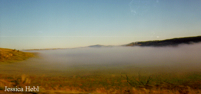
Radiation Fog
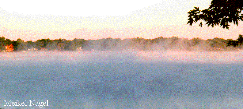
Steam Fog