|
Water Systems
Palmer Drought Severity Index (PDSI; explanation)
Recent Local Drought Information (from NWS)
Statewide Precipitation
- 2010 Maps - Courtesy of Midwestern Regional Climate Center
Precipitation (inches) - and departures from 1971-2000 Normals
See
archive of statewide monthly precipitation maps for previous years (2001-2009)
- Snow to Liquid Water Ratio
Climatology -- St. Louis University
-
Heavy precipitation Frequency
-
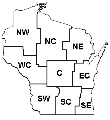
Rainfall frequency graphics for Wisconsin
(data from Rainfall Frequency Atlas for the Midwest, courtesy
of Midwestern Regional Climate Center) (documentation)
Statewide Evaporation
Regional Soil Moisture & Drought
National Drought Information
National Soil Moisture Information
National Precipitation
Current and Anticipated Precipitation Anomalies from Climatic Data Center
Percent of Long-term Average Precipitation (1-60 months) from North American Drought Monitor
National Atmospheric Deposition Program/National Trends Network (NADP/NTN) - sites in Wisconsin
National Operational Hydrologic Remote Sensing Center (NOHRSC)
U.S. Rain Days and Dry Days Products Suite for last 7 & 30
days & since last rain event (from NWS/USGS data)
Heavy Rainfall Frequencies for the US
Precipitation Frequency Information and Publications for Wisconsin from NWS Precipitation Frequency Data Server
Snow to Liquid Water Research
Hemispheric Snow Maps - Rutgers Univ. Global Snow Lab
Hydrometeorological Networks in the US
US Rain Days or Dry Days - US Drought Monitor
Surface & Drinking Water
National Water Systems Forecasts
Runoff and Floods
|


